GEOGRAPHY
In France, in the Provence-Alpes-Côte d'Azur region, the Lérins Islands are attached to the town of Cannes, the tip of Palm Beach is 1.1 km distant from the royal fort on the island St. Marguerite. Facing the Cannes Croisette, Golfe-Juan and Juan-les-Pins, the Lérinien archipelago separates the Gulf Juan, east, from that of La Napoule, closing the south bay of Cannes. In addition, the islands are a point of view on the surrounding mountain ranges, namely, west side, the contours of the Maures and Esterel, and east, the foothills of Grasse, the mountain range Cheiron, or the tops of the former County of Nice, overcoming, in the distance, the snowy fringe of Mercantour-Argentera.
The archipelago of Lérins consists of two major inhabited islands, Sainte-Marguérite and Saint-Honorat, separated by the plateau of Milieu or channel of Friuli, wide 800 meters. A desert island accompanies each main islands: Tradelière east of Sainte Marguérite and Saint-Ferreol island east of Saint-Honorat. The only asymmetry of this table consists of a small rock pile called very simply Islet, located at the extreme south of Saint-Honorat island, bringing to five the number of Lerin Islands. The total extent of the land in the archipelago is around 2.5 square kilometers with a total coastline length of 12 kilometer. Its relief is small, and the islands are relatively flat: the highest point in the archipelago, 26 meters from sea level, is the location of the royal fort on Île Sainte-Marguérite, atop steep cliffs above the majority of lérinien coastline.
With an area of 2.1 square kilometers, the Sainte-Marguerite Island is the largest of the islands of the archipelago. It is also the closest to the mainland and the most visited. The island is almost entirely covered by a forest of pine and eucalyptus. A beltway allows to go around and also, intersected by straight lines through the wooded interior of Sainte-Marguerite, to reach some coves of the south coast.
The island Saint-Honorat is four times smaller than Sainte-Marguerite; it is covered by fields and woodland of the monastery of maritime pines and umbrella pines. To the south of the island is installed the Lérins monastery; an ancient fortress rises on a peninsula in the extreme south, while a port allows to approach the north. As in Sainte-Marguerite, it is possible to make the turn, by taking a path punctuated by seven chapels sometimes in ruins.
The island of Sainte-Marguerite is not conducive to the formation of natural streams within the island. It appears devoid of fresh water springs or wells, and thus long-term uninhabitable. However, there is archaeological evidence of a permanent occupation of Sainte-Marguerite, in particular through the remains of an urbanized oppidum, then a Roman city. We know that the Romans knew how to collect and preserve rainwater; a device for this purpose is visible on the ground floor of the Museum of the Sea: huge Roman cisterns, unique buildings we have coming from antiquity.
As for Saint-Honorat, the eponymous saint of this island would hit the ground with his staff on his arrival at the place, making spring a gush that should never dry up. This legend may make sense if we consider that the Lérinien shallows house a considerable number of submarine springs of fresh water, such as the source of the Boutt.
Now we know with certainty that the French Riviera has seen in 410 a particularly violent earthquake, also referred to in the legend of Saint-Honorat, would have collapsed the archipelago of several meters in the water, which explains why ancient ruins are mostly half submerged today. However, in 1637, these sources were submerged under the sea level, and Lérinien's drought hit again. That year, the Spanish invaders break camp of the royal fort and surrender to their French attackers, overcome by thirst.
Nowadays, fresh water supply of the village of Sainte-Marguerite is provided by a subsea pipeline from Cannes.
HISTORY
The first traces of human life on the archipelago were located north of Île Sainte-Marguerite, as shards dated to the sixth century BC. At that time, an important part of the Provence region and northern Italy is colonized by a so-called Ligurian population. A convenient feature of this population, scattered throughout their territory, involves the construction of defensive structures, known by the Latin name of oppidums, through massive stone blocks arranged in a more or less wide circle. In addition to their protective function, these bastions were used primarily as a public shelter for a small village community.
Alongside the Ligurian activities, the Greeks, who sail from the fifth century BC. between Marseille and Antibes, use the second island, Lero (Saint- Honorat), uninhabited because smaller and more exposed than Lerina as stopover to refuel it.
It is evoked, that Leron the hero, a local entity venerated by sailors passing through, being otherwise unknown in the Greco-Roman mythology, had a dedicated monument in the eponymous Leron island . But such a building, ranging from simple altar to small temple was never found on Lero; it will probably have been destroyed by the Abbey of Lérins, either during the construction of the monastery, either by monks hostile to the presence of pagan shrines on their island.
It seems certain that the islands came under Roman control by the annexation of the Narbonne area to the Roman Empire in year 122 BC.
In the fourth century AD, the city Vergoanum Oppidium needs new porticoes, whose construction necessitated rubble from the razing works of old housing, and scattered throughout the island. The fact is that these embankments, meticulously analyzed by archaeologists since 1976, delivered prodigious discoveries about the composition of the city and the customs of ancient Lériniens. The most prodigious discovery was made during the summer 1981 in one of the upper layers of filling, in which had already been found a large number of various shards, fragments and large Italiot Attic black figure ceramics datable from the second century to the fourth century, attesting relations with central Italy and southern Italy. These same embankments also have paintings of dolphins, unique in Gaul, and dated by comparison at least the second century BC.
The passage to the Middle Ages of Lérinien archipelago is made in the year 410, when a major earthquake hit the Riviera; a tidal wave sweeping coastlines, causing a sharp rise in sea level, on Lerina, the damage is immense
This terrible disaster is often related to Saint-Honorat, freshly arrived on Lero. After his miracles, according to legend (details in next week's article, together with information about the monastery), Lérins islands recover quickly. Monks have inhabited the Saint-Honorat island more or less continuously since 410 and, at the height of their powers, owned Cannes, Mougins and Vallauris, plus Seborga (read our article), in Italy.
From the ninth century, the monastery is facing frequent raids, caused by Mediterranean brigands of all origins, therefore, the abbey will be guarded by soldiers who will live in fortified places of the monastery.
During the Thirty Years War, the Spaniards seized the islands in September 1635 and were driven out in May 1637 by Henri de Sourdis responsible to regain the island Sainte-Marguerite (the confiscated Spanish bronze cannon was melted for the bell of St. Seurin Church, said to be the oldest bell of Bordeaux). Started by Richelieu, the royal fort on Île Sainte-Marguerite was rebuilt by the Spanish in 1635 and designed by Vauban.
Right in the reign of Louis XIV, it is on the island Sainte-Marguerite that will be shut the most famous prisoner of France: September 4, 1687, the Man with the Iron Mask was taken to the royal fort , for a stay of 11 years in a cell opposite to Cannes. His identity was never revealed and remains unknown to date.
During the Austrian Succession War (1740-1748), the islands were briefly conquered by the English.
During the French Revolution, the Lérins Islands were called Marat Islands and Lepeletie.
The Lérins Islands are home to four of the nine remaining cannonballs furnaces in France. Located on the tips of the Dragon and Avenger on Sainte-Marguerite and those of Bonnes Gens on Saint-Honorat, these thermal equipment, built in 1794 on the orders of General Bonaparte, were for heating balls to over 1000 ° C in ten minutes, which supplied the gun batteries positioned nearby.
In 1888, Saint-Honorat island and St. Ferreol island are mentioned in a novel of de Maupassant, where the writer narrates that he made a cruise aboard his yacht Bel Ami, along the Riviera, passing under the archipelago.
Fort Royal on Sainte-Marguerite Island is now home to the Museum of the Sea featuring underwater archeology collections. You can also visit the cell of the Iron Mask, as well as those in which six French Protestant pastors were imprisoned after the revocation of the Edict of Nantes. It houses also a hosting center and a Mediterranean aquariums hall.
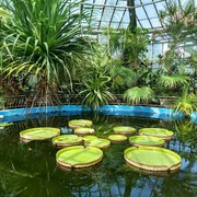
[About the Monastery, the Méditerranoscope (Lérin's Biodiversity Project) and the Grand Jardin (Great Garden), see our following article next week.]
VIDEO: https://www.youtube.com/watch?v=5Yu9sRRPUk0
VIDEO: https://www.youtube.com/watch?v=84w4gJyk_4k
VIDEO:VIDEO: https://www.youtube.com/watch?v=HW09kiRYdrs